Want to track coastal resilience? Wondering who is most vulnerable to climate change? Hope to monitor changing sea levels? There is a UCSC-developed app for that (and it is White House recognized, too). There are also programs for tracking mountain lions, mapping global inequality, and recording melting ice caps - all tools developed at UCSC’s Center for Integrated Spatial Research (CISR).
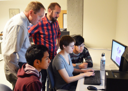
CISR is a hub on campus that creates geographic informations systems (GIS), interactive maps of location based information that help us better understand our ever-changing environment. Also known as spatial data, a GIS map is big data visualized that allows for a multidimensional analysis. Think Google Maps meets Simcity.
“Every problem has a spatial component,” says Erik Lowe, a researcher at CISR and an alum of the Environmental Studies program.
When facts and pieces of information are contextualized into one map, patterns can be found and problems can be identified. Users can analyze and manipulate data to examine the environmental, societal and economic implications.
“GIS is an unbelievably powerful tool,” remarks Aaron Cole, also an analyst at CISR and a UCSC alumnus as well. “It provides insight about the information of how and where something is happening,” he adds.
GIS has long played a significant role in efforts to understand and address a range of natural and socio-economic problems, including those of social and environmental equity. “For example, studies of environmental injustice often involve debates around community location (and composition) and their proximity to toxic hazards which are inherently spatial phenomena. Measures of environmental equity across a geographic region are readily developed in a geographic information system by combining spatial data on environmental hazards with socio-economic units like U.S. Census tracts.” says CISR Staff Director, Barry Nickel.
From oceans to mountain tops
Jeff Bury, an Associate Professor of Environmental Studies and Faculty Director of CISR, addresses the impact of climate change in extreme, high altitude regions. He integrates GIS mapping with political economic data to address hazards to some of the world’s most vulnerable populations. Read more >
Mapping coastal resilience
One of the biggest impact CISR is making right now is through its involvement with the Nature Conservancy. Collaborating with Stanford’s Natural Capital Project, University of Southern Mississippi, and U.S. Geological Survey, CISR has mapped the ecological and socioeconomic hazards of rising sea levels and storm surges.
The ocean is worth $100 billion to the global economy, with 300 million people making a living on fishing, tourism and aquaculture (Spalding, 2014). Marine degradation has devastating ecological, economic and societal consequences.
...And from mountain tops to mountian lions
Chris Wilmers, as Associate Professor of Environmental Studies, uses the GIS lab to track how urban, human habitats impact the behavior of mountain lions in Santa Cruz county. Learn more >
Knowing both obstacles and opportunities to managing coastal resilience is key for policymakers and practitioners. Being able to manage these risks is imperative.
Thanks to the GIS system CISR developed, coastal and marine concerns can be precisely pinpointed. For example, if a city planner needs to know what coastal towns are most at risk during a storm surge or what population is most economically vulnerable due to rising sea levels, they can use the CISR-developed app to help guide their decisions.
...And from mountain lions to sea lions
Barry Nickel, Director of CISR and lecturer at UC Santa Cruz, combined animal tracking data with a mapping of human activities to show the human impact on top ocean predators along U.S. west coast. Through this study, high impact areas where efforts to most effectively reduce impact were pinpointed. Read more >
The maps and applications that CISR helped develop are already being used in areas that are regularly impacted by natural disasters like Southeast Florida and states along the Gulf of Mexico as well as New York and Connecticut that were ravaged by Hurricane Sandy in 2012.
“Geospatial technologies, like GIS and remote sensing, are important tools for understanding and supporting resilient communities faced with natural and man-made disasters, e.g. supercharged storms, drought or flooding, and sea level rise. These technologies increase our capacity for risk reduction by allowing decision makers to contextualize current and future risk in terms of place as well as identify a suite of solutions for reducing their social and economic impacts.” says Nickel.
Participate
CISR’s state-of-the-art facilities make it a destination for researchers in the conservation and academic communities. CISR has worked across the UCSC campus including Anthropology, Latin American & Latino Studies, Economics, History, Ecology & Evolutionary Biology, Ocean Sciences, Earth & Planetary Sciences, Computer Science, Computer Engineering, and Applied Mathematics & Statistics. CISR also supports non-academic campus units like Business and Administration, Fire, Transportation Services, Physical Planning, Information Technology Services, Office of Sustainability, Center for Agroecology & Sustainable Food Systems, UC Natural Reserve System, and the Arboretum and has developed applications for the UC Office of the President and the UCSB and UC Davis.
UCSC students can also sign up for classes at the lab and also get involved in research through internships.
